São Filipe Smart Tour
February 19, 2024
Author: Samory Araújo, Head of Solutions Mapping, UNDP Cabo Verde Accelerator Lab

The São Filipe Smart Tour project aims to transform the tourism experience in Cabo Verde through innovation and sustainability".
Tourism Sign System
Tourism plays a crucial role in Cape Verde's economic and social development, and initiatives such as the São Filipe Smart Tour project are essential to promoting sustainable growth, especially for communities like São Filipe and Fogo Island.
Tourist signs, an essential part of heritage interpretation, aim to facilitate and guide the flow of tourists in any city. The implementation of an effective signposting system plays a fundamental role in the dynamics of tourism, making information on tourist attractions an essential means of promoting the destination.
Through smart tourism investments, São Filipe can capitalize on its natural beauty, cultural heritage, and unique attractions to attract visitors, create jobs, and boost local businesses. The project will not only enhance the tourism experience for visitors, but also benefit the community by improving infrastructure, preserving cultural landmarks, and promoting environmental sustainability.
The UNDP, through the Accelerator Lab, with the support of partnerships including the Vitó project, has invested in this initiative by the Municipality of São Filipe to promote the valorization and conservation of cultural and environmental heritage as a driver of economic and social growth in São Filipe.
A mobile phone, the internet and a QR code
Each tourist attraction is geo-referenced with GPS coordinates to facilitate location and mobility between sites / monuments in the tourist signposting system, so that visitors know how far they have to travel.
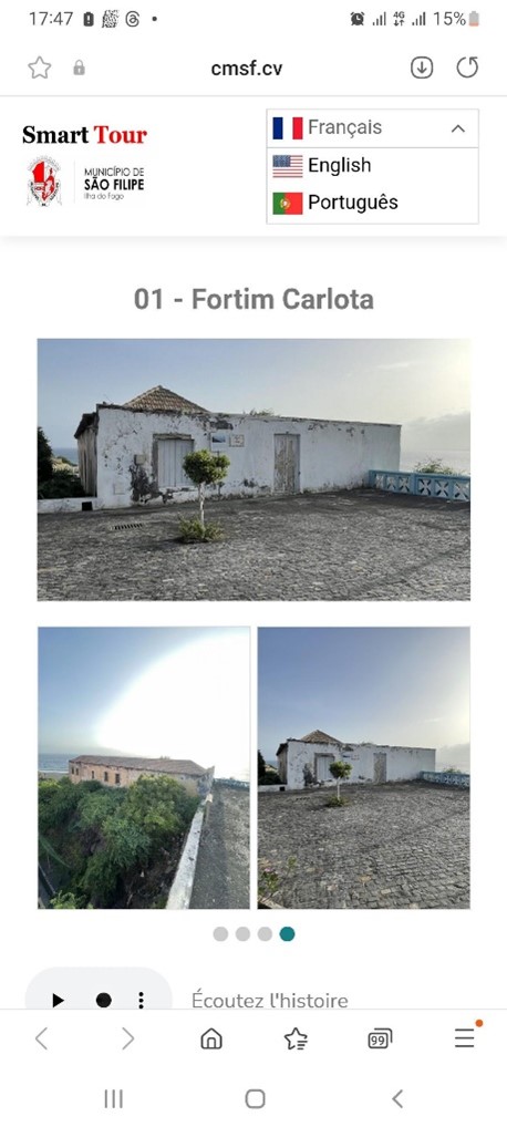
Each monument has a QR code that directs visitors to a platform cmsf.cv where they can access information about the attraction. Information on each tourist attraction is available in three languages and in text form.

The São Filipe Smart Tour project aims to transform the tourism experience in Cabo Verde through innovation and sustainability".
Tour Map
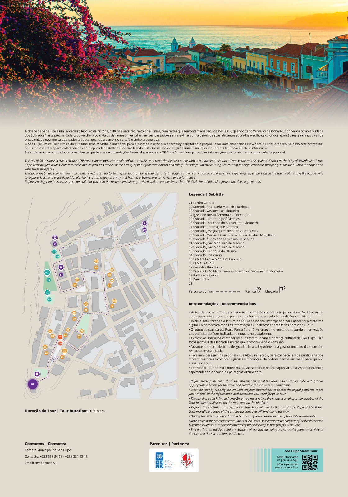
To provide a tourist itinerary of the main historical sites / monuments of the City of São Filipe, the tourist signage system consists of:
1) Main signage, with a map of the municipality so that visitors can see the layout of the city and the location of each of the historical points. Each historical point is identified numerically on the map. This main sign has a QR code on it, which directs the visitor to general information about the municipality of São Filipe.
2) Sites / Monuments / Points of Interest signs, which identifies the name of the site and the reference number on the map so that you can locate where it is situated.
3) Secondary signage, which provides continuous orientation along the tourist route. Its purpose is to facilitate continuous navigation, ensuring that tourists enjoy a fluid and organized experience when exploring the historic sites and monuments. This addition aims to further improve accessibility and understanding of the proposed tourist route.

Providing tourists and visitors, as well as residents themselves, with data on various places of historical and scenic interest allows them to obtain information more quickly and comprehensively, leading to a fully personalized trip. It is also a highly beneficial process as it reduces the time spent searching for information and allows visitors to have everything they need at their fingertips in a matter of seconds.

Secondary Signage MOBY
Installed in areas with the highest population, informing and assisting visitors about the São Filipe Smart Tour:
Structure with double-sided information panel face
Electricity to recharge electronic devices through the solar panel
Bench for relaxation

Conclusion
In this first phase of the "São Filipe Smart Tour", 22 buildings and monuments have been included, highlighting places of historical interest, but also facilitating access to them through intelligent digital signage. This project not only promotes local tourism, but also preserves and celebrates cultural heritage, contributing to the sustainability and development of this community.


 Locations